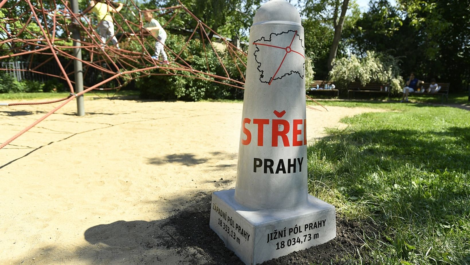

On Friday, June 4, a new landmark appeared in Prague – a concrete pole installed on the geographical center of the city.
Wondering where is it? Here you go: Na Balkáně street in Žižkov, Prague 3.
“I always knew that Prague 3 is the navel of Prague. But now it has been confirmed to the nearest centimeter,” joked Jiří Ptáček, mayor of Prague 3.
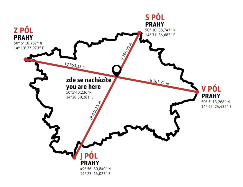
The Prague Poles are the farthest points of the territory of Prague in all four cardinal directions. The poles are determined by the border between the capital city and the Central Bohemian Region.
The poles were marked in November 2020 by Ondřej Boháč, director of Prague Institute of Planning and Development and Czech reporter Janek Rubeš. They are marked by 180kg concrete poles.
The North pole lies on the border between the cadastral area of Třeboradice and Hovorčovice, on the southeastern edge of the outskirts of Hovorčovice, in the Veleňská street near the railway crossing. The place is publicly accessible.
The South pole of Prague lies on the border of Zbraslav and Zvole, about 200 meters from the outskirts of Vrané nad Vltavou. The point is located in the floodplain on the right bank of the Vltava river between the A2 cycle path and the road connecting Vrané nad Vltavou and Jarov.
The East pole lies in the Klánovice Forest near Klánovice on the border of Újezd nad Lesy and Úvaly, about 500 meters west of the outskirts of Úvaly. The place is publicly accessible. It lies about 50 meters away from the forest road with a green tourist sign.
The West pole of Prague lies on the border of Dobrovíz and Ruzyně, about 500 meters southeast of the outskirts of Dobrovíz (the Amazon complex), in the Security restricted area of the airport, so it is inaccessible to the public. The concrete column with a description is therefore located at the end of the access road in front of the airport area, in a publicly accessible place about 100 meters from the geodetic west pole itself.

-
NEWSLETTER
 Subscribe for our daily news
Most Popular