
Canadian International High School in Prague: Your Pathway to Top Universities Worldwide
Partner article

Heart of Europe – this is how Prague, is often called. The largest town of the Czech Republic is located in the centre of Bohemia, in the Vltava river valley. But how was Prague divided in the past?
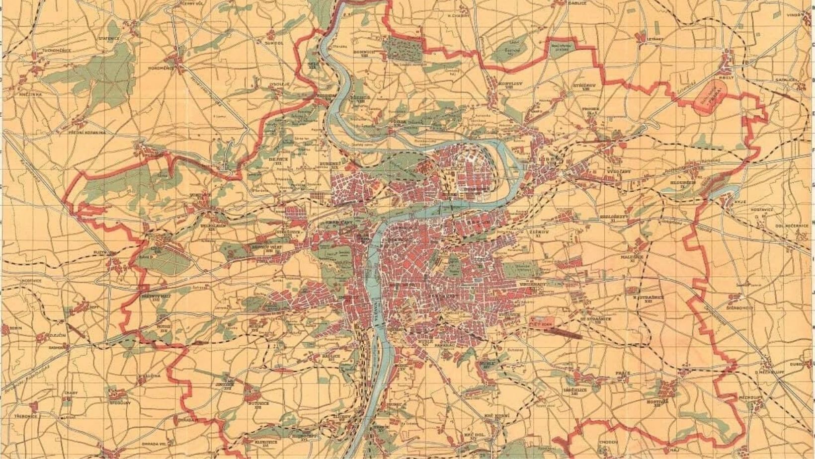
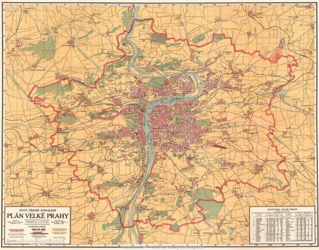
When we say Prague today, we see a Greater Prague which was created in 1922 when a large number of surrounding villages were connected to the original inner town.
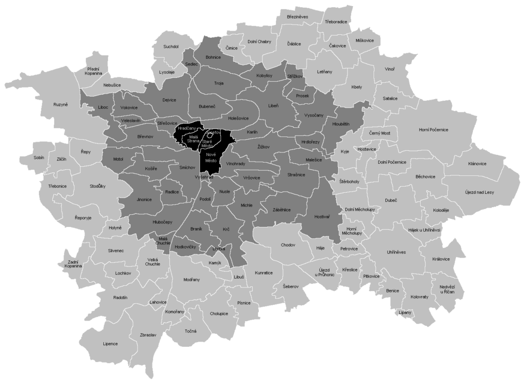
The inner town consisted of two parts, Prague I – Old Town, Prague II – New Town, Prague III – Lesser Town, Prague IV – Hradčany (castle part), Prague V – Josefov, Prague VI – Vyšehrad.
Greater Prague consisted of a number of smaller or larger villages which were near to the original centre. Wikipedia again has a great map of the division of Inner Town (black), Greater Prague (dark grey), and the new parts which were connected after WW2 (light grey).
Development of administrative division
Although the towns of Prague formed a territorially continuous whole, they were still administratively separate. After unsuccessful attempts by Charles IV (1367–1377) and later by Jan Želivský (1421–1424) and Jan Pašek (1524–1528) to join the Old Town and the New Town, the unification of the four towns of Prague (Old and New Town, Lesser Town and Hradčany) hadn’t taken place until 1784. The court decree of 12th February 1784 by Joseph II created a unified Prague.
Despite efforts to negotiate unification with the suburbs, only few of them had joined Prague before World War I. In 1883, the State Diet approved the incorporation of Vyšehrad as VI quarter of Prague (the Town of Vyšehrad Hill was constituted in the 15th and 16th century.
They had sought its incorporation since 1845.) In 1884, Holešovice-Bubny became VII quarter of Prague and the last town to join Prague before World War I was Libeň in 1901.
Negotiations with the biggest or closest Prague suburbs dragged on through the last quarter of the 19th century into the beginning of the 20th century. They were held mostly in the years 1881, 1896, 1902 and 1911, yet with no result.
Just like in 1784, the formation of an administratively unified city had to come from the government’s intervention from above, regardless of the fact that the territories, housing, infrastructure, transport, and so on had been interlinked for a long time.
This time, the unification was amended through the Act on Establishment of Great Prague of 6th February 1920 (Act No. 114/1920 Coll.), which came into force on 1st January 1922.
This act connected the following municipalities to Prague Bohnice, Braník, Břevnov, Bubeneč, Dejvice, Hloubětín, Hlubočepy, Hodkovičky, Hostivař, Hrdlořezy, Malá Chuchle, Jinonice, Karlín, Kobylisy, Košíře, Krč, Liboc, Malešice, Michle, Motol, Nusle, Podolí, Prosek, Radlice, Sedlec, Smíchov, Strašnice, Střížkov, Troja, Veleslavín, Královské Vinohrady, Vokovice, Vršovice, Vysočany, Záběhlice and Žižkov.
At the same time, Prague was divided into 13 districts, marked with Roman numerals as Prague I–XIX. (Prague I–VII, i.e. the original Prague, formed one district.)
In 1946, a separate district was established for Prague VII and in 1947, XX district was established (Strašnice, Hostivař and part of Záběhlice – Zahradní Město).
In 1949, after administrative reorganization, Prague was divided into 16 districts, this time marked with Arabic numerals. After this change, the area of Prague was 171.5 km2.
Would you like your story featured here? Get in touch with our team at [email protected]


![]() Subscribe for our daily news
Subscribe for our daily news

Don’t have an account? Register

We will come back to you within 24 hours with our proporsal